Saturday, July 2, 2016

Dawson City, Yukon Territory

June 29 to July 1 – Dawson City, Yukon Territory
Dawson City, Yukon Territory is the last town before we leave Canada but this little town had a lot to see and we ended up spending the better part of three days. The little town with a population of 1,800 or so and is small enough to walk from one end to the other in 15 or 20 minutes. This was taken from a small mountain just west of Dawson City called the Dome. The dark/light colors in the river is the confluence of the larger Yukon River and the smaller Klondike River.


It was a fun combination of tourist shops yet "real" people live there so the town has to supply their needs with grocery, hardware and other staples that we all desire in our regular lives. The streets are dirt and not very busy. It's easy to walk in the street instead of on the boardwalk.  


Many of the old buildings still stand. Most were abandoned because the whole town is built on permafrost and the owners failed to keep them level. A resident told us there is a man in town who's full time job was leveling buildings. Here home was built in the mid 1990's and has already been relabeled a couple times. It all gives this little town it's personality. 


Gold mining put Dawson City on the map and gold mining is still big business with many claims being actively worked throughout the area. Heading to Dawson City, we saw a sign directing us to Dredge No. 4, a Klondike Historic Site so we headed 5 miles up a dirt road to a HUGE contraption that was used to pull gold from the ground. Dredge No. 4 was built and operated from 1913 to 1959. There were 66 buckets powered by electric motors; each one scooped ½ cubic yard and good days would haul in 800 ounces of Klondike gold.


Bonanza Gold Campground just outside of town so we checked in, rearranged the camper and had dinner are Klondike Kate’s (the celebrate Carolyn’s birthday) before we heading up Dome Road to a place where early residents of Dawson Creek decided to celebrate the summer solstice. Some time during the 1890’s, three preachers were invited to give inspirational talks on June 21st, the longest day of the year but the crowd was sparse. The few who were there decided to go ahead with the celebration anyway and the tradition continues today. We missed the summer solstice by just a few days but wanted to photograph the midnight sun so we headed up the five miles to the Dome. The view from the top is quite spectacular. There are mountains all around and all of Dawson City can be seen from the crest of the hill. Sunset was at 12:36am and were weren’t disappointed. Besides an amazing sunset, there was light rain on the opposite horizon that produced a colorful rainbow.


While waiting for the sun to set at the Dome, we talked to others who suggested several places in town for us to visit before we head to our next stop. We visited the museum - checked displays, attended various educational presentations and watched an early movie the early days of Dawson Creek. We ended up spending several hours there before heading back up to Dome Mountain for a replay of the night before but there were too many clouds for a good sunset. We ended up talking to other Rvers until it was bed time and ended up just jumping in the Roadtrek and spending the night on Dome Mountain.

We had a great night sleep on Dome Mountain but we were in a cloud when we woke. No problem, just wait a while and the cloud will lift so we made breakfast and patiently waited an hour or so until the sun poked through.


 Today, was July 1st, Canada Day (Canada’s version of our 4th of July) so we stayed a little longer in Dawson City the enjoy Canada’s birthday. Yes, there was a parade, a great one even if it only lasted six minutes. 


Then, everyone went to the museum where the flag was raised and O Canada was sung (the lady had a great voice, BTW) followed by a picnic lunch of smokey brat, watermelon and cake. 


It was a wonderful and fun community event shared with strangers like Carolyn and I.  Thank you Dawson City!!!

Tuesday, June 28, 2016

Driving the Alaskan Highway

June 27 – There’s no turning back now! We are on the Alaskan Highway and heading to Whitehorse, AK.

This is Dawson Creek, British Columbia and “Mile 0” of the Alaskan Hwy and a must-do for every first time traveler is to take a photo in front of the Alaskan Highway sign. We were no exception so we posed for pictures and were on our way. The official end of the highway is 1523 miles northwest near Fairbanks, Alaska. We hope to get to that spot in a few weeks and I’ll take a picture of that spot too!


The highway itself is paved but segments are always being repaired.  We drove a good number of miles on wet gravel, so our poor Roadtrek is looking a bit sad right now. There are also sections that can have a few curves.


Along the way we discovered we had a leak in one of our two fresh water tanks. The inside 10 gallon tank was empty.  We found a water refill location so we could try to locate the leak. Sure enough, we found a plastic fitting had broken. Fortunately, it is on the line that feeds the exterior tank.  We just had to move a couple valves in the system and we can make the fresh water system work perfectly until we can get home and make the repair.

BUT, the day had lots of bright spots. We saw lots of wildlife. We saw eight black bears, one cow moose, three bison (two HUGE bulls), a few deer and a grey fox.


After all that, we found another free camp site. This time along the Yukon River and 25 miles from Whitehorse, Yukon Territory. We met some travelers who had just come from three weeks in Alaska and shared some tips about road conditions, places to see, and activities that we might enjoy.

After a great night sleep, we awoke to noises that we soon discovered were beavers swimming in the Yukon river next to our camper and slapping their tails.  Soon we headed across the bridge for another great day.


Monday, June 27, 2016

Heading to Watson Lake

June 26 – on our way to Watson Lake, BC and the beginning of the AlCan Hwy, but there are lots of miles before we get there.

One notable point is that this would be our lowest gas price for a LONG, LONG time. .984 per liter. If all my calculations are correct, that works out to $3.07 per gallon when I work in all the exchange rates, etc.. Not bad, and we would soon be wishing for similar gas prices as we topped off at other stations up the road.

We stayed at the Walmart in Fort St. John, BC. We asked for permission to spend the night…sure, for one night we were told, so we found a nice quiet spot in the back corner of the lot behind the garden center. After enjoying a small ice cream treat we jumped into the RT and hunkered down for the night.

We had learned our next door neighbor’s house back home had been struck by lightning and damaged by fire so we hunted for wifi to learn more. We found wifi and helpful folks at the Fort St. John visitor center. Our house is fine but, unfortunately, our neighbor’s house suffered extensive fire and smoke damage. They were not home so, thankfully, there were no injuries.

The folks at the visitor center were great and the facility they have is amazing. It was recently built with many donations from the gas and oil companies who are drilling throughout their area. One of the workers said it cost $315M and includes two full size ice rinks, an olympic speed skating oval, a walking track and a local school. Well done to those who donated to this community project!


Today was a bonus wildlife day. We counted our first black bears along the highway. The roads have a wide area of 100 feet or so where wild alfalfa grows. At least it looks like alfalfa to me. Anyway, the bears love that stuff and eat it like crazy. Of course, they recently woke from winter hibernation so they must be catching up. 

We also got lucky when we came around a curve and saw two Rock Sheep Ewes with their youngsters. 


One of our goals on this trip was to visit the Sign Post Forest in Watson Lake. As you can see by the photo below, it's an area with 10 to 12 foot posts that are covered with signs that people attach to the posts. There are home-made signs, store-bought signs, signs with city and village names, and much much more.


We brought a sign that is special to Carolyn and me, but REALLY special to a group of young men. We added a 2/8 coin in honor of the Marines and sailors who served our country. We found a post with several military patches already attached, so it was appropriate for 2/8 to join that group. If you ever have a chance to visit the Sign Post Forest, look for the coin on the first post on the left inside the new front gate.


We boon-docked at a Racing River turn-out. There were a couple other units boon-docked but we had a nice secluded spot down by the river. Free camping and a river to sing you to sleep is liv’n large!

Friday, June 24, 2016

Banff and Jasper National Parks


June 24 – Banff & Jasper NP.  Today we cross the border into Canada. There are three border crossings near Glacier National Park. Sweetgrass, MT is about 25 miles east of Glacier on I-15. The center crossing is on Hwy 89, the road that runs near the eastern edge of Glacier NP and goes to Cardston, Alberta. The third crossing is a gateway between Glacier NP and Waterton NP on the Canadian side of the border.

We filled with gas on the U.S. side and headed north toward Cardston. A couple miles south of the border we stopped to clean a few carrots, onions and apples which are [sometimes] not allowed into Canada. Everyone tries to figure out what foods are allowed and which aren’t but, in this case, it wasn’t a problem. We pulled into the entry lane and were asked the typical questions and sent on our merry way by the pleasant Canadian Border Guard.

The first major town in Canada is Calgary. From there, we could take the main highway north to Edmonton then go west toward Grande Prairie. The other option was to take Hwy 1 from Calgary and go through Banff and Jasper National Parks. We decided on the latter and I wonder how I could have even considered any other route. Even in the rain, the road through Banff is amazing. Every turn in the road leaves you with an oh-my-gosh moment.

A bonus was seeing the first big critter of the Canadian portion of the trip. A huge bull elk was on the edge of the tree-line chewing his dinner. Unfortunately, we saw him too late to pull over for a photo but we have great memories of him.

We traveled through Banff into Jasper NP. Unfortunately, the rain continued so we kept moving knowing we will travel this section of road again on our return trip toward home. We camped at Mosquito Creek campground right along the highway. It rained much of the night but our little Roadtrek was warm and cozy.

We woke to sunshine and continued the trip north. Even though it’s late June, the mountain tops are still snow covered and the views are breathtaking. What else can you say about the views? Breathtaking? Amazing? Unbelievable? They all fit.

Along the way we stopped at several pull-offs, but the longest was reserved for the Athabasca Glacier. The drive to the parking area has signs marking the historical locations of the leading edge of the glacier dating back to the early 1900’s. Over the past hundred years or so, it has receded a couple miles.

The mountains are grand...

and the lakes aren't bad either!

In front of the Athabasca Glacier
The leading edge of the glacier was here in 1942.

This young lady was celebrating her 27th birthday and dressed in her Canadian Rockies best outfit.
What a concept. All electric Tesla pulling the Pod with mounted solar.
Hwy 93, the main route through Jasper NP, goes through the town of Jasper, Alberta. What a great town. Of course it thrives only because of the tourist industry, but it’s kept spick and clean and everyone we talked to was helpful and friendly. We made a quick stop at the info center and were on our way.

Just outside of town we encountered a small herd of elk.  They were mostly cows and a few yearling bulls. Later we learned they stay in this area because it’s close to town where the wolves tend to stay away.

Soon we were off Hwy 93 and onto Hwy 40 near Hinton, AB. The sign near the junction read “Rte 40 Scenic Route to Alaska”. I have to admit, it wasn’t bad. We spent the night at the Gregg Lake Campgound in the William Switzer Provencial Park. 

Thursday, June 23, 2016

Glacier National Park


June 23 – Glacier National Park. We won’t have time to see the whole park or even do much hiking. The Going To The Sun Highway is one of the key attractions at Glacier so off we went on the 52 mile drive across the mountain with a plan to return later in the afternoon when the sun would be behind us.

Of course, we are always on the lookout for wildlife, and we scored our first big hit just a couple miles from the campground. Cars were stacked along the road (the first sign that wildlife are around) and we spotted a bear quite a ways off the road. I had my camera and telephoto lens sitting on the floor beside me. I snapped off just one shot before a park ranger “reminded” me that I wasn’t properly parked off the road and had to move along. Looking at the photo, the bear appears to have the tell-tale hump of a grizzly, but a closer look at his snout makes me believe it was most likely a chocolate colored black bear.


A highlight is the Going-To-The-Sun road. It is a national scenic road that traverses Glacier NP  and crosses the continental divide near Logan Pass. Parts of the road gets up to 80 feet of snow and generally takes until early June to be open to the public. The road is narrow and has many switchbacks so vehicle traffic is restricted to less than 21 feet. Our Roadtrek worked just fine.


Park visitors can also ride one of the Red Jammer tour buses. The tops pull back so passengers can stand to take photos.


There are several glaciers in the park but Jackson glacier is the only one left to see from the road. Like most glaciers, it is receding rapidly and it is estimated that ALL glaciers will be gone by 2030 – only 14 years from now.


And there are great views of lakes, streams and waterfalls.


The highest point of the road is just over 6,600 feet at Logan’s Pass.


We had a bonus at Logan Pass – Big Horn Sheep were on the mountain across the road from the visitor center. They blended with the surroundings so well that we would not have noticed them if it weren't for others who pointed them out.


While there is no bad time to visit national parks, but I’m beginning to favor spring. Especially, in mountainous areas, because the snow adds to the color and contrast. Flowers are blooming and wildlife are giving birth to their young.


 Tomorrow we will cross into Canada. I’m still undecided whether to travel the main road through Calgary and Edmonton or if we should take a bit longer and travel through Banff and Jasper National Parks.

Wednesday, June 22, 2016

The first few days

We’re off. Sunday morning, 9am, and we are on the road. The bookend days for this Alaskan trip were June 18 and August 27th.  Yesterday (June 18) was the 1st birthday party for our grandson Jax and August 27th will be our granddaughter Myna’s 1st birthday party. That gives us about nine weeks to reach Alaska and see the sights on our bucket list.

Ever hear of the 330 rule? It’s easy to keep going down the highway too long so some campers try to stick to a rule to stop for the evening after 330 miles or 3:30 in the afternoon. The obvious reason is simply not to over-do the driving...slow down and enjoy the trip. As they say, rules are meant to be broken and we will hightail it westbound at least until we get past some of the midwest scenery that we are used to seeing.

The first day we pounded out a little over 700 miles across Indiana, Illinois, Wisconsin and a good chunk of Minnesota. Traffic through Chicago and Minneapolis was tough but glad to get those towns behind us on Sunday instead of battling the weekday fiasco. Anyway, we landed at a campground in Clearwater, MN.

A week or two before we left I contacted a friend who I'd worked with and we planned a quick stop. Vicki lives near Grand Forks and she invited us to stop by her gorgeous home for lunch. Thanks Vicki, it was a great lunch and it was wonderful to catch up on what’s happening in our lives.

After a couple hour layover, we jumped in our little tin can and headed west on US Hwy 2. OK, a short geography lesson. There is a short portion of U.S. Route 2 that goes between Rouses Point, N.Y. to Houlton, MA at the Canadian border. The longer portion crosses the northern portion of the lower 48 from St. Ignace, MI to Everett, WA. A distance of almost 1,800 miles. The route took us past farms with cattle, lots of corn, soybeans and wheat. Even a canola. Ever see canola grow? It has a bright yellow flower and we caught it at a great time. Huge fields of yellow flowers. Oh, and we saw the sugar beet museum. The Red River Valley of Minnesota and North Dakota has lots of sugar beets. I have a soft spot for sugar beets since it was one of the first crops I worked with when I started my career with BASF. 25 tons of beets per acre at 18% sugar content makes a lot of sugar cubes!!!


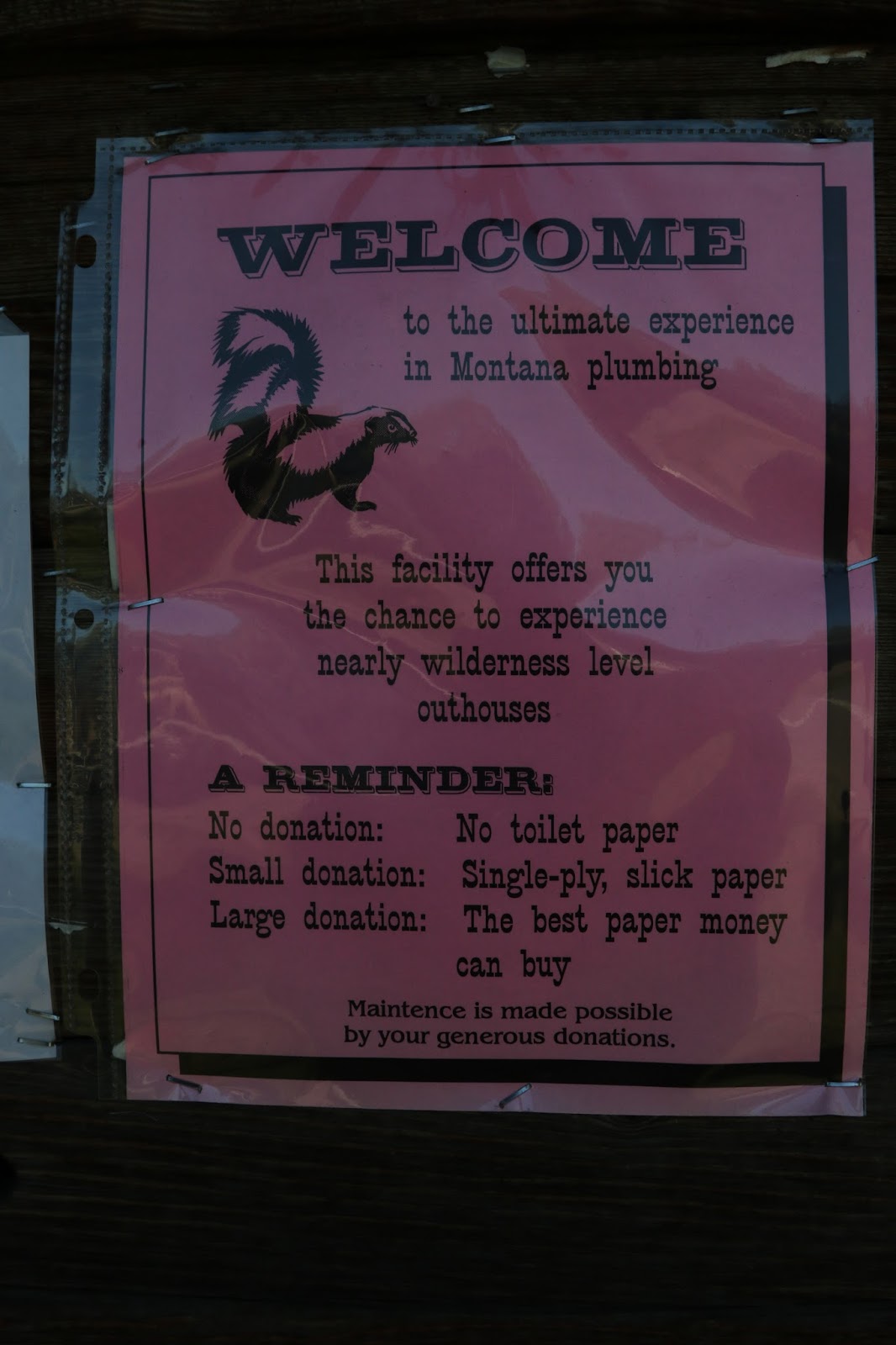
Some of the best rest area facilities...
Be sure to read the rest area rules.


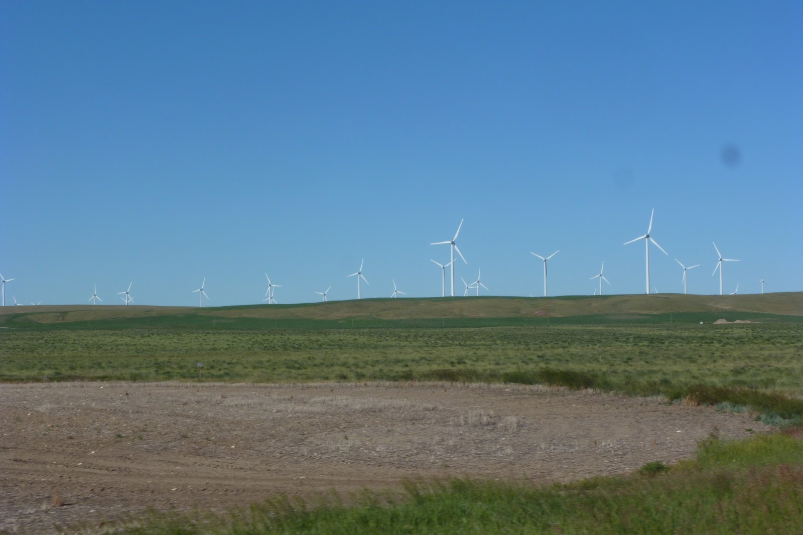
I wonder if the folks across the Dakota’s and Montana ever get used to wind. Dang, 30 MPH head winds sure do cut down on fuel mileage. We can only hope mother nature gives us a nice tail wind on our way home in a few weeks. 

Remember the 330 rule? Busted it again, but it was OK because on Thursday morning we entered Glacier National Park and snagged a first-come-first-served camp site in St. Mary’s campground.  THAT is where our Alaska trip gets the official start!

Tuesday, May 24, 2016

Getting ready for Alaska - The Last Frontier

A month from now we will be (at least we SHOULD be) heading toward Alaska...The Last Frontier.

We had planned this trip last year but our two sons and daughters-in-law had other plans.  We were blessed with our first grand son on June 19th and our first grand daughter arrived August 24th. So I guess you can imagine, our planned 2015 trip to Alaska was put on hold until 2016. And yes, adding two grands made the wait ALL worth it.

Now our plans include one more criteria...DON'T miss 1st birthdays! No problem, there are nine weeks between birthdays - more than enough time for an Alaska trip, so we will head westbound following Jax's big day and will be home to celebrate with Myna on her special day. Wow, we have an exciting summer in front of us!

We have been looking at maps and going over The Milepost - a travel planner that literally has mile-by-mile explanations of Alaskan highways. We've been making notes but we don't make a day-by-day checklist. We will see where the roads take us.


The Roadtrek is always kept in good mechanical shape so no concerns there, but there are always some final things to do. Over the past few weeks, I've sanitized the water system and converted all the lights to LED's that are more energy efficient when we are on battery power. Carolyn has been busy making the bed more comfortable and adding nice coverings. I'll have to add photos when everything is done.

Speaking of photos, from time to time, we will add posts with some photos and maybe an occasional video. Just check back every few days.